|
Free SE Submission
Free Womens Mag Free HTML Editor Free Search Toolbar Keyword Research SEO Toolkit Competitive Intel |
  
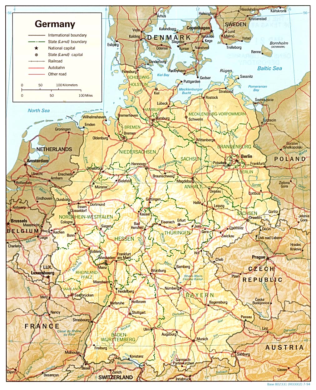
Country, historical and thematic maps from the Perry-Castañeda Library Map Collection, along with links to maps on other web sites.
City maps of Berlin, Hamburg, Munich and Cologne.
Political map and transparent German state boundary map. Small GIF images of Germany maps, suitable for use on web pages, permitted by the author.
Interactive 360° panorama photographs of a number of German cities.
Photographs of the German region Eifel.
Regional / Europe / Maps_and_Views |
|