|
Free SE Submission
Free Womens Mag Free HTML Editor Free Search Toolbar Keyword Research SEO Toolkit Competitive Intel |
  
Picture collection of Dutch cities.
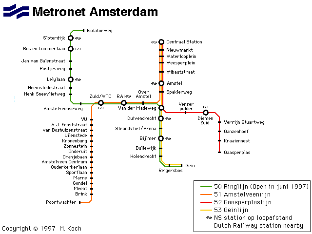
Map of the subway system of Amsterdam.
50 Holland city maps from 1650 atlas Toonneel der Steden. Site is in English; some maps include city histories in Dutch.
Virtual Tours of Amsterdam, Haarlem, Marken and Brugge.
Contains full color physical and political maps as well as key facts and statistics.
Offers a selection if Dutch windmill photos.
Historic photos canals in the Netherlands.
Image gallery of Holland by Alex Sievers.
This site is exclusively about Keukenhof tulip gardens in Lisse, many views and photographs.
Interactive map of the nuclear power plants in the Netherlands, and just outside its borders.
Regional / Europe / Maps_and_Views |
|