|
Free SE Submission
Free Womens Mag Free HTML Editor Free Search Toolbar Keyword Research SEO Toolkit Competitive Intel |
  
USGS topographic and geologic maps of Alaska.
Maps showing both current and forecast Alaskan weather.
A compact map showing locations of major cities and national parks.
Alaskan maps provided by the University of Texas at Austin
A basic map designed to be easily duplicated for classroom use. Available in two versions, one with city names and one without.
Large collection of virtual reality panoramas taken throughout the state.
State map showing general locations of native villages, along with major streams and roads. Available in several formats.
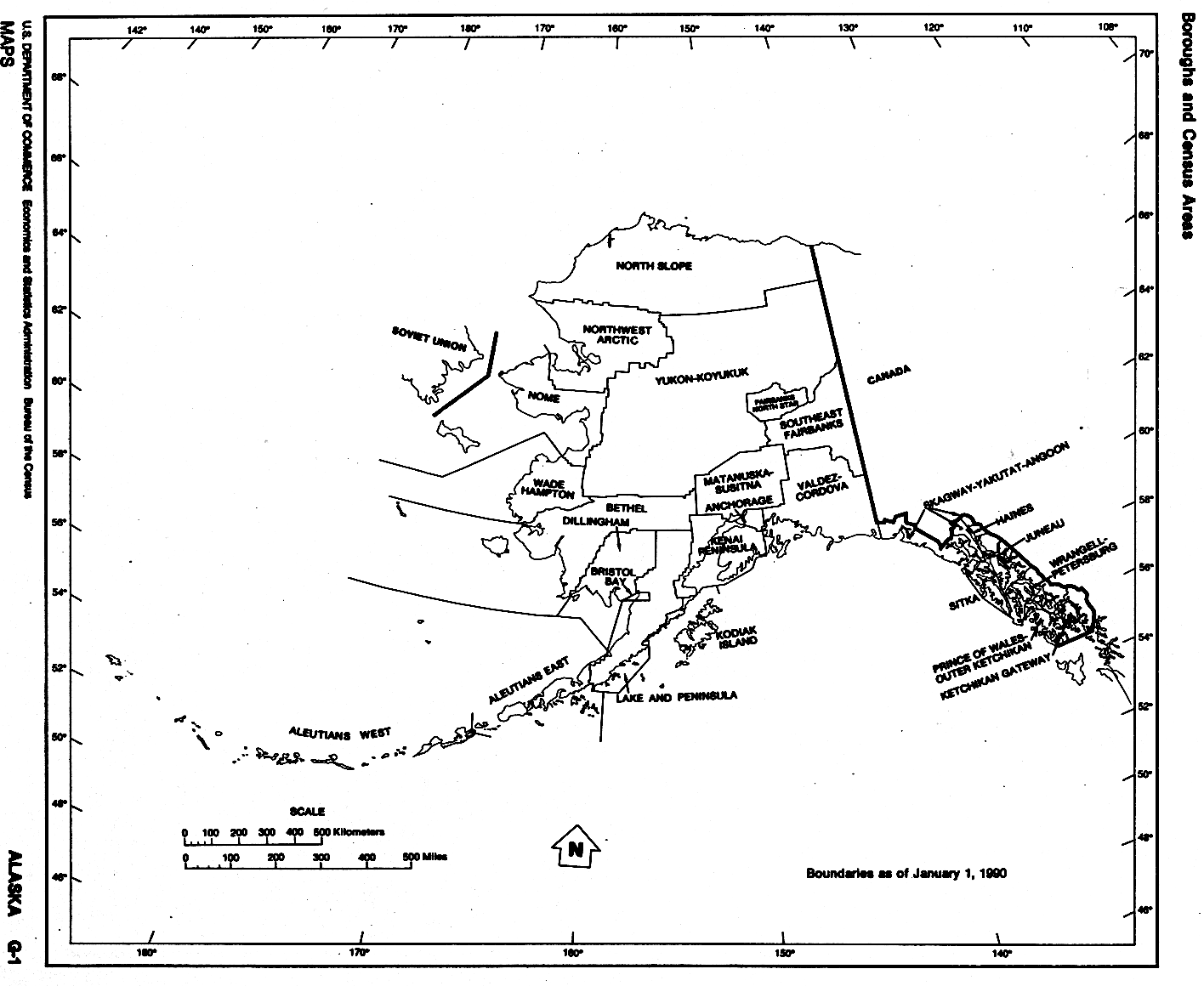
Census Bureau map showing outlines and names of the state's boroughs and census areas.
Maps and graphics from the United States Geological Survey cover various areas of volcanic activity.
Color-coded map showing mean annual precipitation in Alaska and Yukon.
Regional / North_America / United_States / Maps_and_Views |
|