|
Free SE Submission
Free Womens Mag Free HTML Editor Free Search Toolbar Keyword Research SEO Toolkit Competitive Intel |
  
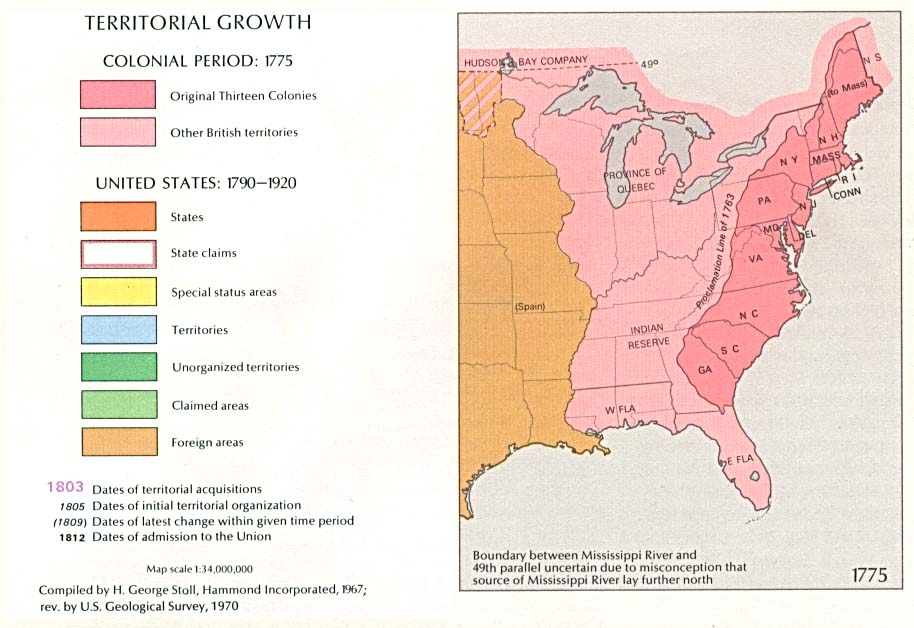
Map showing the original Thirteen Colonies, British territories, states, state claims, territories and foreign areas.
Collection of early maps that chronicles the effects of European exploration and settlement in north-eastern North America.
Reproductions of old maps showing family names towns in New York, Massachusetts, New Hampshire, Vermont, Maine, Rhode Island, and Connecticut. 1860s-1870s.
From the U.S. Geological Survey.
Showing towns as they existed in 1675 in Massachusetts, Connecticut and Rhode Island.
Map from the late 1700's showing counties and townships in the two states. Provided by the University of Connecticut Map and Geographic Information Center's Historical Scanned Map Collection.
Reference / Maps / Historical |
|